12 August 2018
Backpacking in Bannau Brycheiniog
‘What the hell is Bannau Brycheiniog?’ you’re probably wondering… Well, if that’s the case, then we succeeded in drawing your attention to this post. Now, before we explain its meaning, let us… just joking, no more stupid tricks. Bannau Brycheiniog is a Welsh name of a national park in the south of Wales, called Brecon Beacons in English. In this post, we try to convince you that it’s a nice place to go to. We concentrate on the central part of the park, comprising many of its highest peaks, including the highest one, Pen y Fan (886 m), and we mostly write about hiking and camping, which is what we like doing best. Having said that, Brecon Beacons has a lot more to offer, including waterfalls you can look at from behind (near Ystradfellte), beautifully set ruins (Carreg Cennen Castle) and spectacular caves (Dan-yr-Ogof). Plus horse riding, bird watching, mountain biking and star gazing (designated International Dark Sky Reserve). Chances are, whatever your hobby, you won’t get bored.
In English, Brecon Beacons
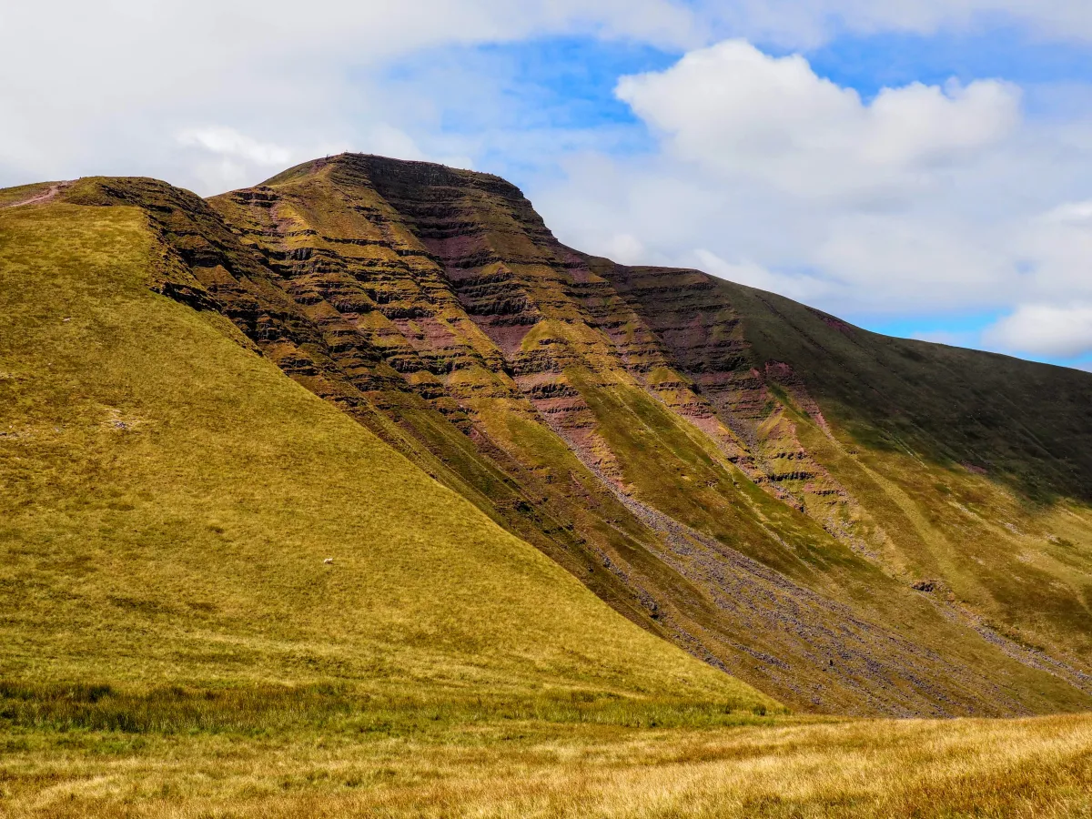
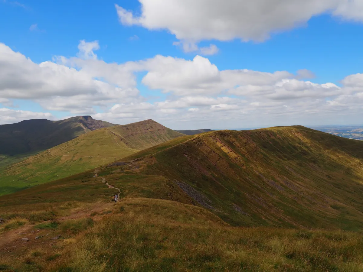 Main peaks of Brecon Beacons - from behind: Pen y Fan, Cribyn and Fan y Big
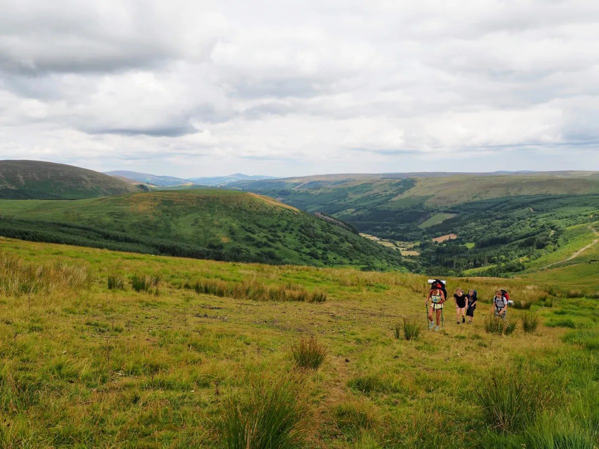
So what’s cool about Brecon Beacons? Well, shaped by the Ice Age, the landform is really breathtaking. U-shaped ridges overlook initially steep, then flattening valleys. Everything is uniformly green, gentle as if it was formed following a simple mathematical equation. Only the winding paths and occasional lakes disrupt this homogeneity, for better or for worse. All the main peaks are in close proximity to each other and share many geographical features - steep on one side, flat on the other, a bit like sand dunes as if shaped by the wind.
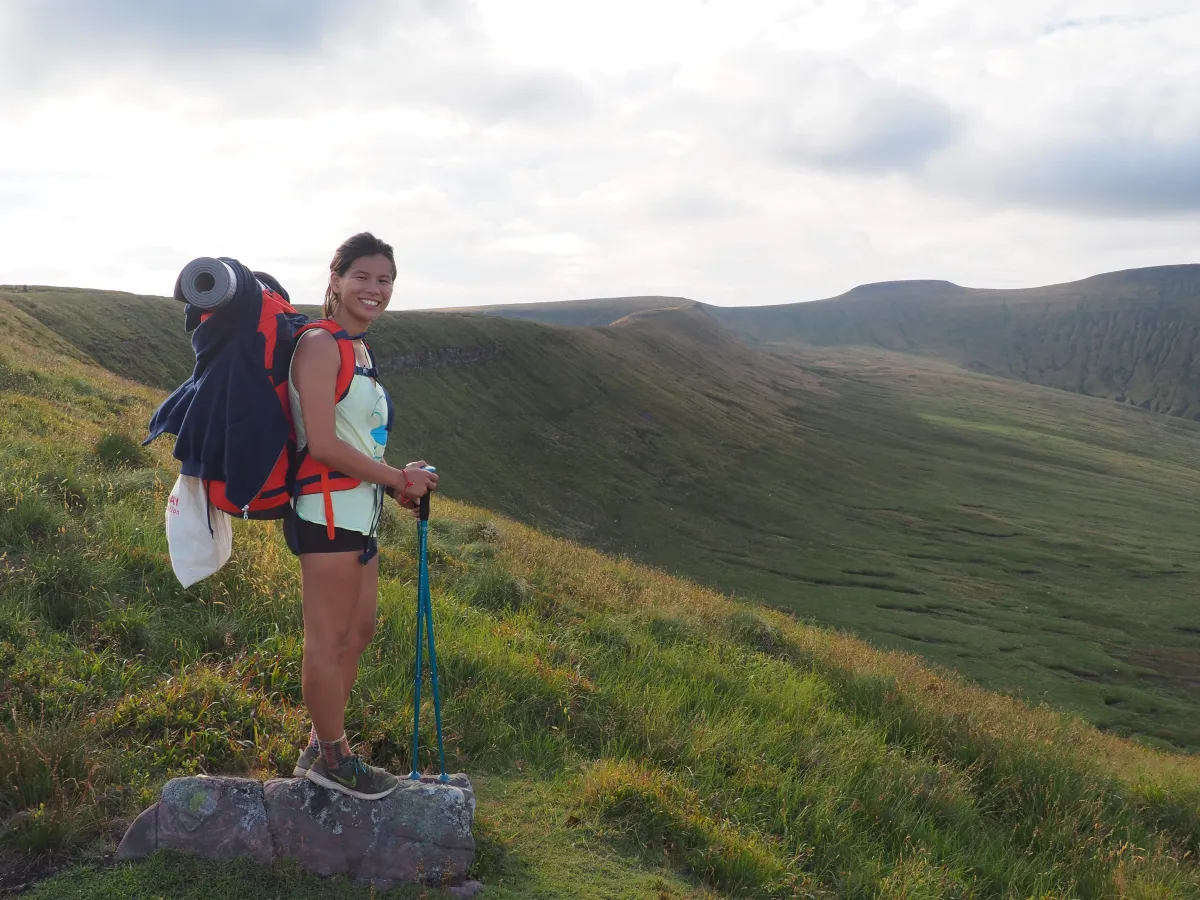
Hiking is physically demanding - paths are steep at times, and it’s rarely flat. If you add a 15 kg backpack to the equation, you might feel your legs the next day!
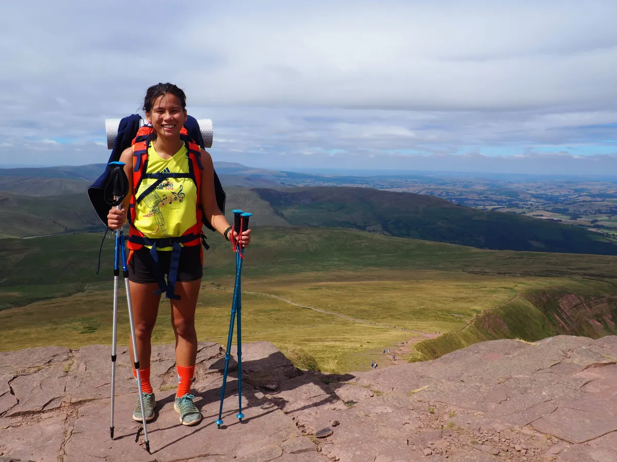
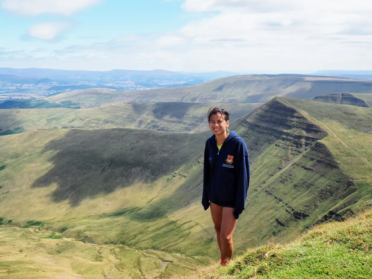
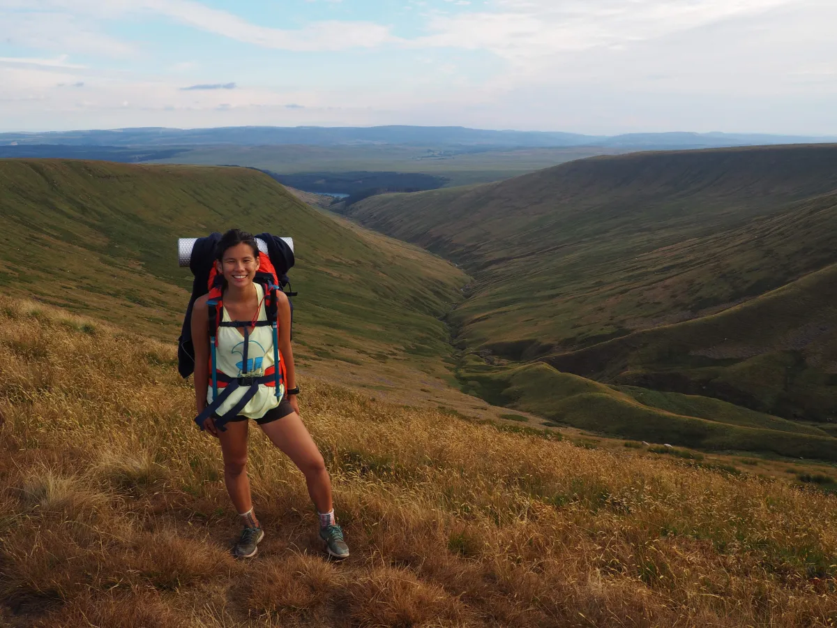 Smiling as it was the first peak only :)
Central Beacons
By far the most popular route in Central Beacons is Storey Arms -> Pen y Fan and back. It’s possible to get to the starting point by bus, but most people drive in - there’s plenty of parking available and we believe it’s free. It’s roughly 3.5km each way, with a little over 300 m elevation gain. Most of the way is a relatively strenuous climb, but picturesque setting and views from the top make the effort worth it.
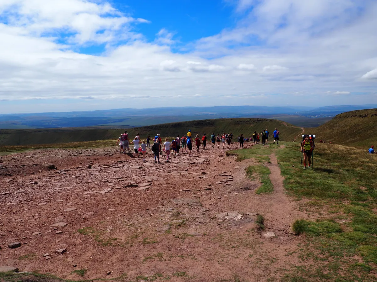 Crowds await as you approach the peak of Pen y Fan
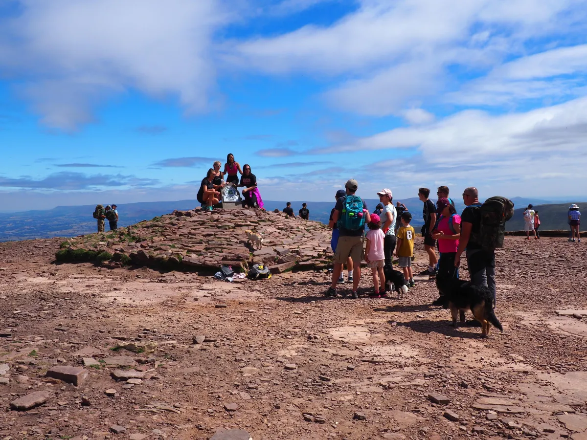 A queue to take a photo at the top of Pen y Fan, the highest point of Brecon Beacons
Recommended 1/2-day route
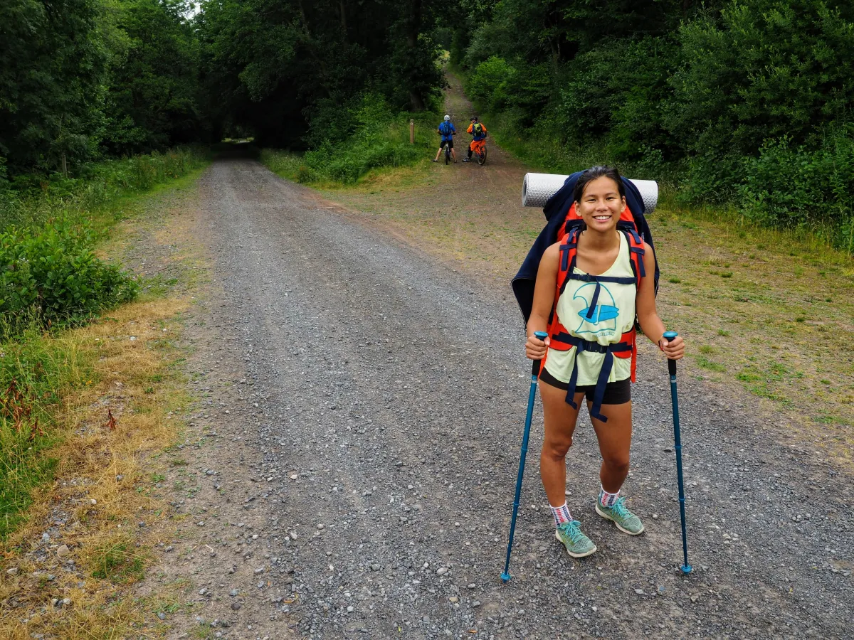
The Storey Arms -> Pen y Fan path makes for a really nice half-day hike, but we needed a route that would occupy us for the whole weekend. As usual, the aim was to find a circular walk of around 30 km, with a nice wild camping spot midway, safe parking and not too many people en route. Additionally, we thought it’d be nice to pass by some lakes, and potentially have a swim in one or two. A brief Google Maps search resulted in a promising itinerary, which we describe below.
Our 2-days Circular route
Day 1: Aber Village -> Talybont Reservoir -> Lower Neuadd Reservoir -> Llyn Cwm Llwch
Our starting point was Aber Village, where limited parking is available in little bays along the main road (ours was near Yew Tree Cottage). From there, we headed south, towards Talybont Reservoir, which was supposed to be the first attraction of our Welsh weekend.
Talybont Reservoir
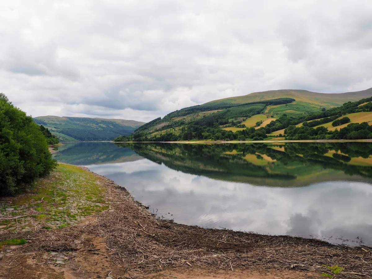 Nice reflection, eh?
It’s quite a big lake, so it’s pretty impressive, but swimming is not allowed, as is typical for reservoirs. The best place to see it is definitely its north shore, where the dam and a few information plaques are also located. From there, we took a wide path/narrow road southward, along the east shore of Talybont.
It’s a really long, straight lane, surrounded by dense vegetation, slightly uphill at all times. Just as it starts getting monotonous, you reach the end of the forest, where the path becomes more exposed and views more exciting.
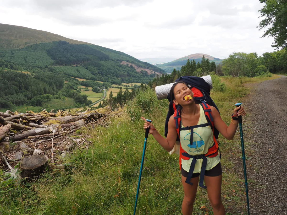 Escape from the forest celebrated with a peach
A little more (slightly steeper) uphill and you reach an asphalt road, where you might get a hot-dog if you’re hungry and lucky (we assume it’s there on most summer weekends, not too expensive either btw).
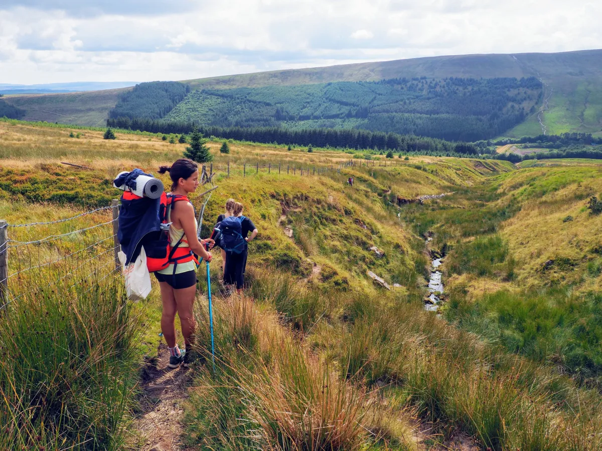
A shortcut, that ended on a longcut…
From there, we headed to the Lower Neuadd Reservoir, but to make it more exciting we decided to take a shortcut, which started with a steep ascent, with pretty sights at the top.
Unfortunately, upon reaching the high point of the hill, we seemed to have lost the path and had to struggle for a while through long grass and uneven ground. The reward for going astray came in the form of berries, which were plentiful in these unexplored areas.
The next challenge awaiting our fellowship were little rivers crossing our route. Luckily, the trip came towards the end of a heatwave in the UK, so the dried out waterways didn’t even deserve to be called ‘streams’ - ‘brook’ seems more appropriate. Still, if you couldn’t jump long enough, you’d get your feet wet and muddy, as can be seen below.
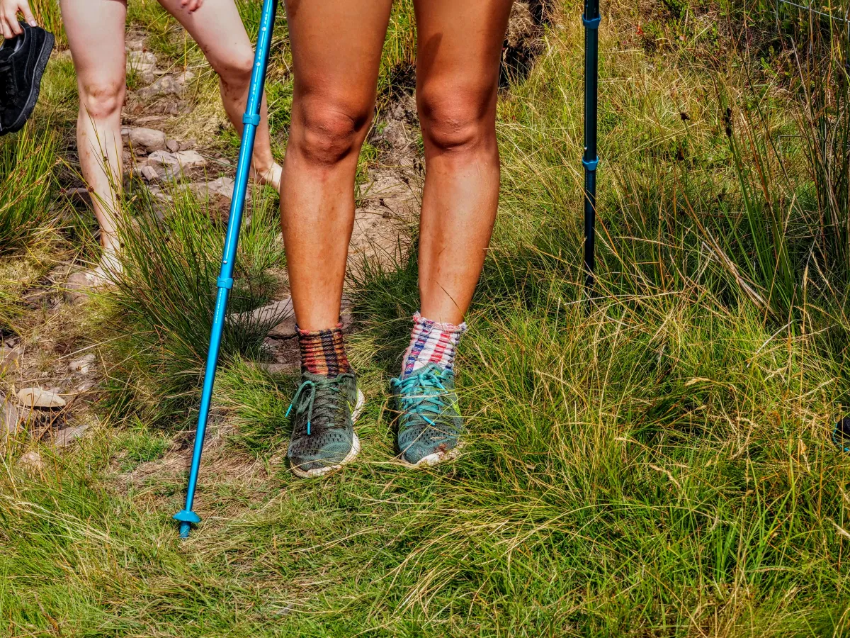 Jumping rivers is def not for poor short Wendy…
Fortunately, having dealt with wet surprises, we eventually found our way, this time following a stream on a rugged path that took us straight to Lower Neuadd Reservoir.
Did the shortcut save us time? Probably not. Did it save us distance? Not likely. Was it worth it? Undoubtedly yes. YOLO. For more serious expeditions though, we should probably equip ourselves with a physical map and/or invest in one of those apps with OS maps, rather than depend on Google Maps for directions. Lesson learned.
Lower Neauadd Reservoir (no water…)
Soon afterwards, we arrived at the reservoir, but something was not quite right; it didn’t look like it was supposed to. We quickly realised that what’s missing was… water. Well, not that there was no water, but there was a lot less than expected.
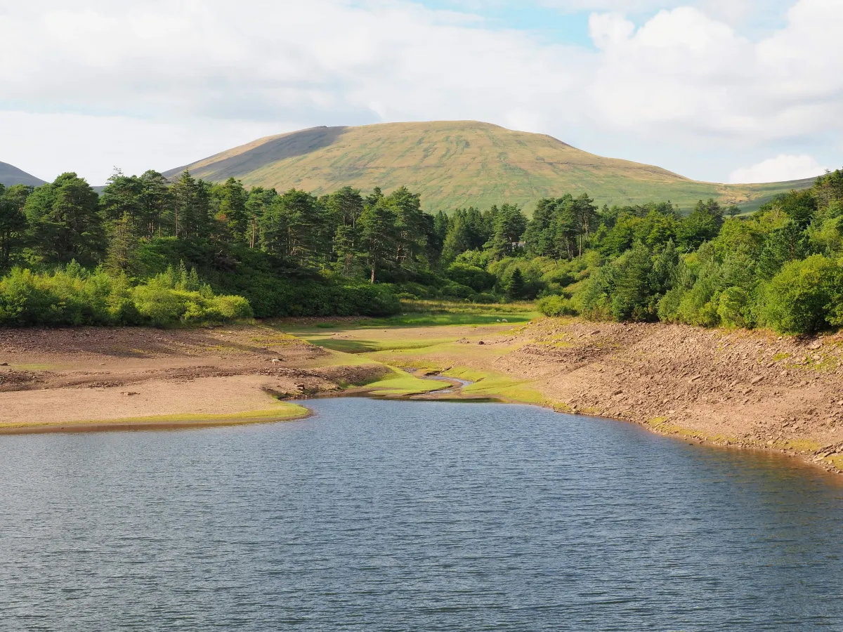 Water levels lower than usual
Underwhelmed by what we saw, we decided we’d pass on the swimming, and instead rest, have food, dry our socks and continue to the last stage for the day, which was going to take us all the way to Llyn Cwm Llwch (yes, Welsh is a weird language), a glacial lake just below Corn Du (second highest peak in the park, very close to Pen y Fan).
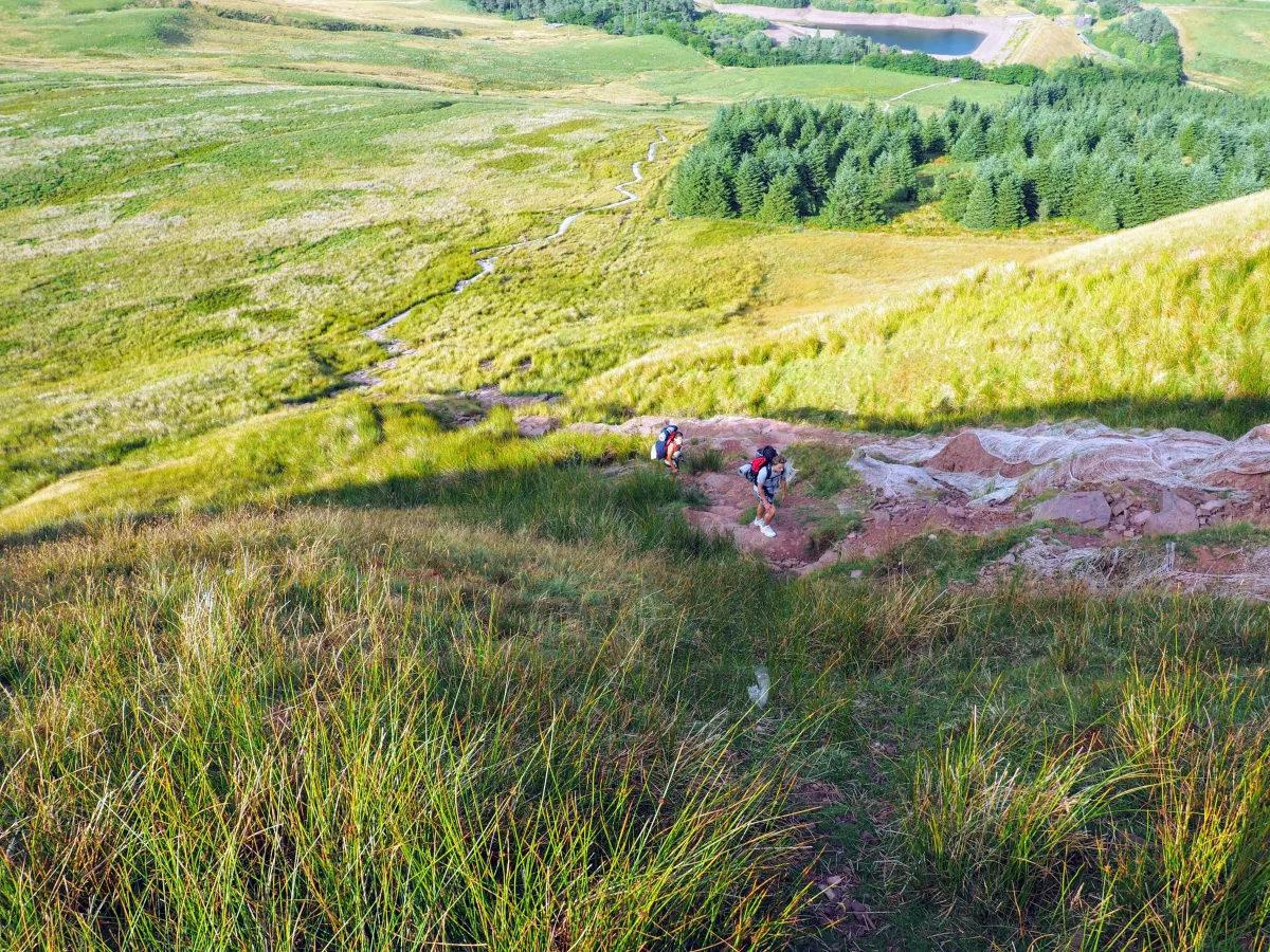 Steep, winding path leading to the ridge
A steep climb and a long, exposed ridge, with ever improving vistas took us there in mere 2 hours.
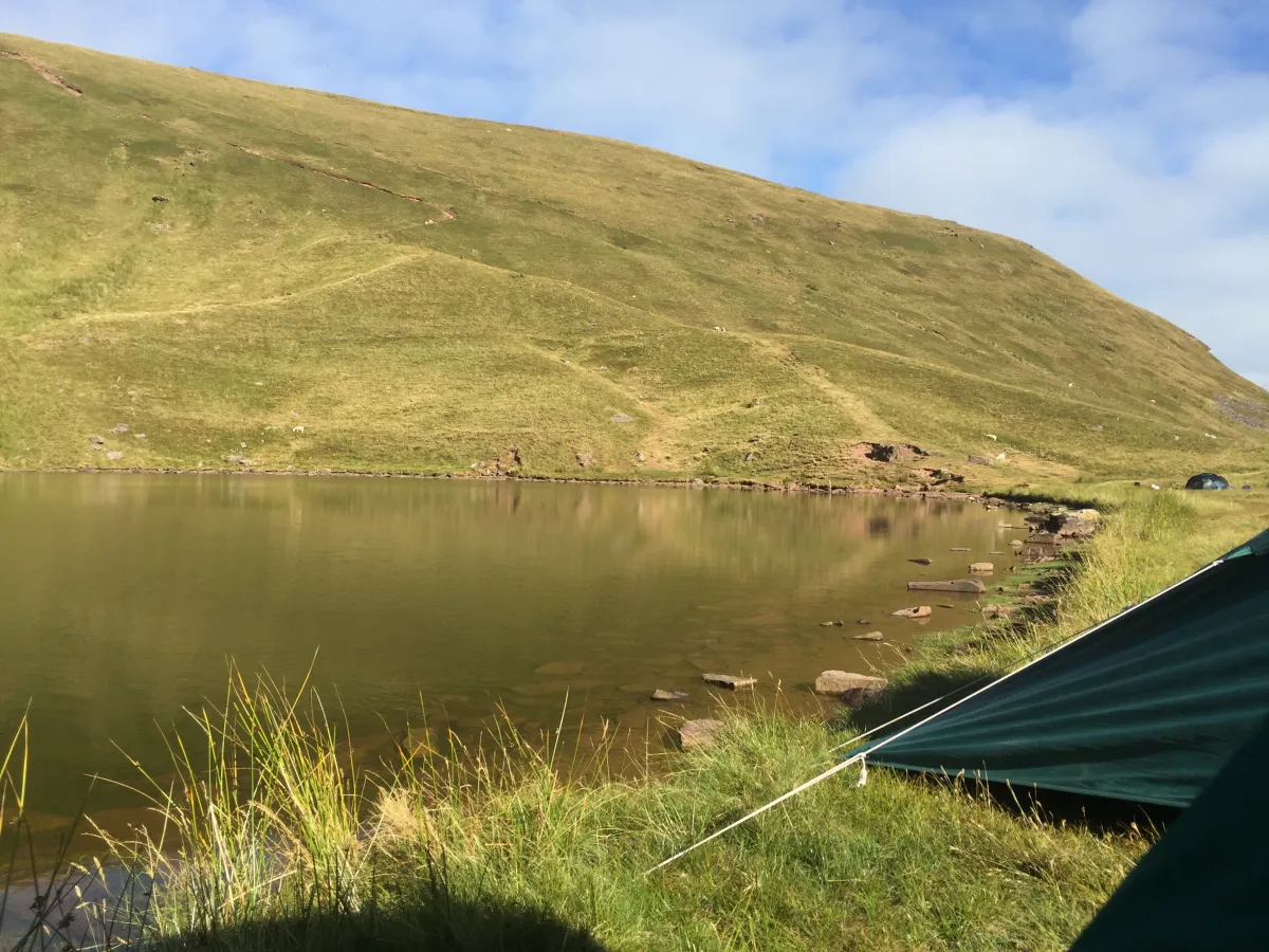
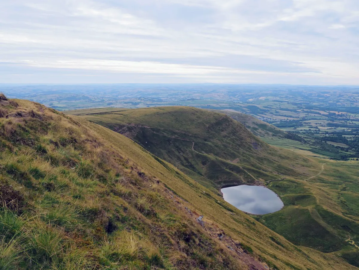
Llyn Cwm Llwch (wild camping spot + sheep)
As soon as we got sight of the lake, we knew it was a great wild camping spot. Surrounded from all sides (as lakes usually are), with a few flat areas just by the shore, proximity to park’s highest peaks and berry bushes nearby, you couldn’t have asked for a better place to pitch a tent.
On the way, there’s an obelisk commemorating Tommy Jones, a 5-year-old kid who got lost in the mountains in 1900, while hiking with his father. After a 29 day long search, his body was found where the obelisk is now standing. Goes to show the power of the mountains (even as low as they are in the UK).
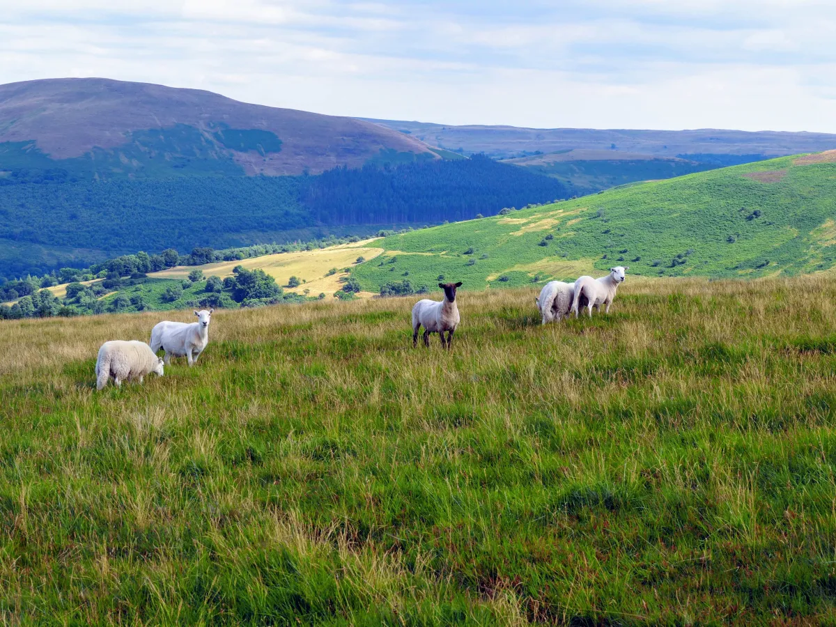
Although the water was not the cleanest or the warmest you could wish for, taking a dip seemed like an obligation. Since both photographers were in the water, no pictures were taken, but you have to take our word for it that even Wendy swam! Then supper, a quick game of Hanabi, birthday celebrations (Wendy turning 21!) and off to sleep… Well, not quite. One thing we haven’t mentioned so far is the multitude of sheep. Perhaps that shouldn’t come as a surprise, given that we were in Wales, where sheep to human ratio is over 3. That’s more than three sheep per person, not the other way round (which by the way is still less than in New Zealand, where the ratio is currently around 7 and used to be 20 in the past). Looking from another perspective, every third sheep in the UK is from Wales.
- There are sheep jokes (“What do you call a Welshman with many girlfriends? A Shepherd”) and derogatory terms such as “sheep shagger”.
Anyway, sheep like grassy mountains a lot and apparently feel quite comfortable there so they are pretty much everywhere. And they bleat. A lot. Day and night. Nonstop. Beeeeee. Beeeee. Sleeping in nature, there you go. Great British wildlife.
 Sheep. May they die in hell for waking us up at 6 am…
Day 2: Llyn Cwm Llwch -> Corn Du -> Pen y Fan -> Cribyn -> Fan y Big -> Aber Village
Best way to start the second day of a backpacking trip after 6 hours of interrupted sleep? Well, we could think of better things than a 10 km run with 500 m elevation gain. But if you’ve got 1 litre of water between 5 people and another 20 km to walk, someone’s got to make a sacrifice and run for resupply. Well, one could walk, but that would take too long, wouldn’t it? At least a refreshing swim awaited at the completion of this important mission - thanks Maciek!!
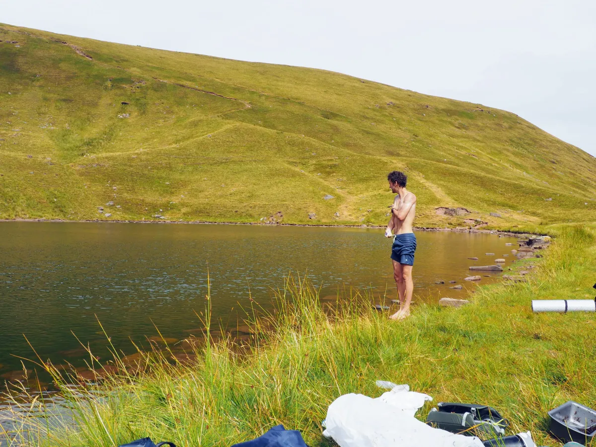 Morning bath after a 10km water search run (Maciek our hero)
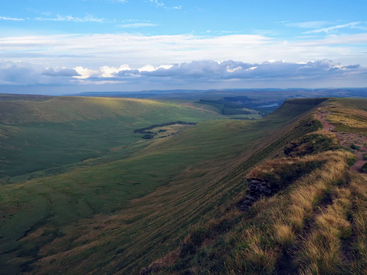
Conquering the four peaks
With our bottles full and hopes high, we set off for what was supposed to be the icing on the cake of our trip. Four peaks and eternal glory awaited ahead, all we had to do was walk. And we did. As mentioned before, all the peaks are near each other, they’re all pretty similar, but the views differ substantially. It goes pretty much like this: Climb. Admire. Drink water. Take photos. Descend. Repeat. The nice thing is that once you pass Pen y Fan, the number of people drastically decreases. And when you leave Fan y Big behind you, you’ll barely see a human being for the next couple of hours. What you will see though, are sheep. Granted.
Rather than rambling on about the beautiful scenery and our great adventures, we’ll just leave you with some photos, since, as they say, a picture is worth a thousand words.
I Corn Du
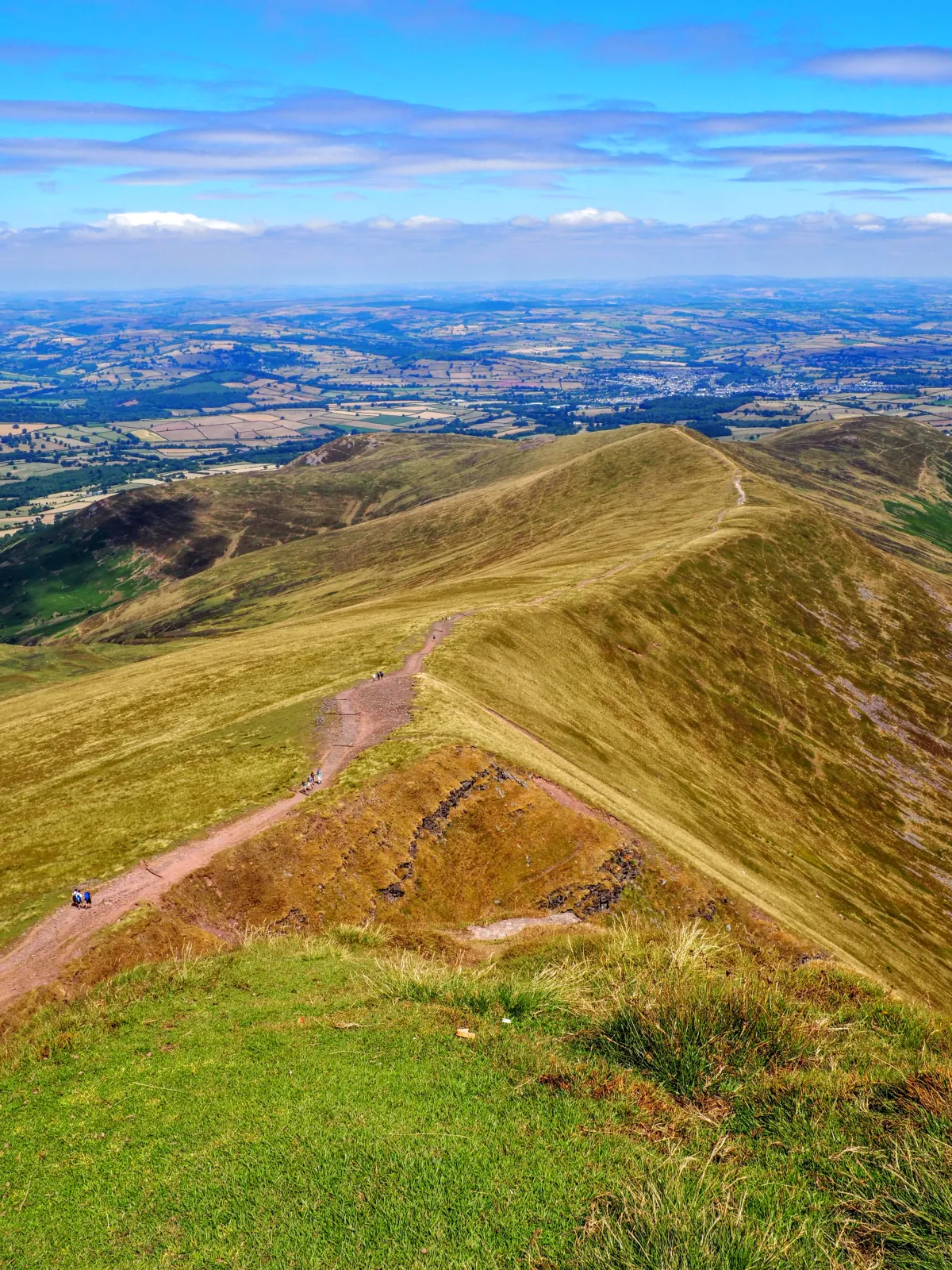
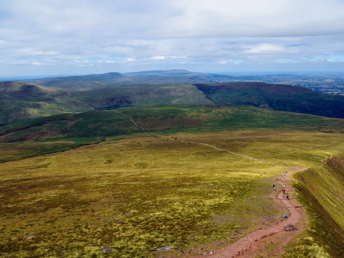 The main path to Pen y Fan, starting at Storey Arms, as seen from Corn Du
 Happy kid
II Pen y Fan
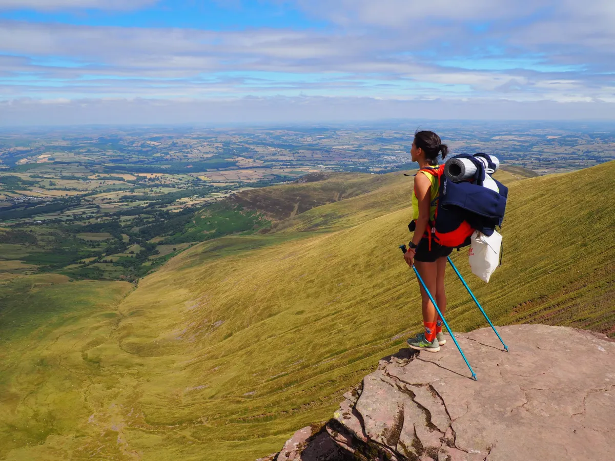 Admiring the scenery
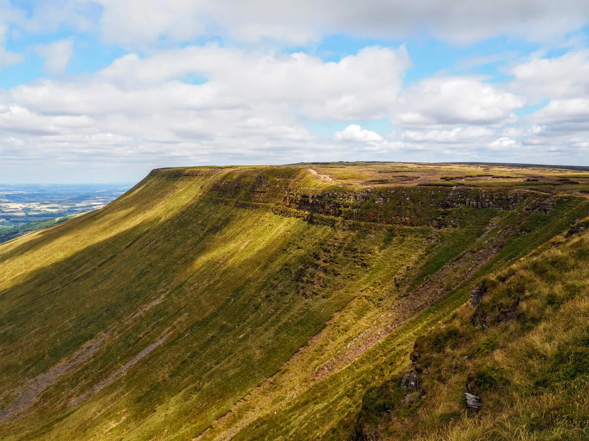
III Crybin
IV Fan y Big
 Formidable
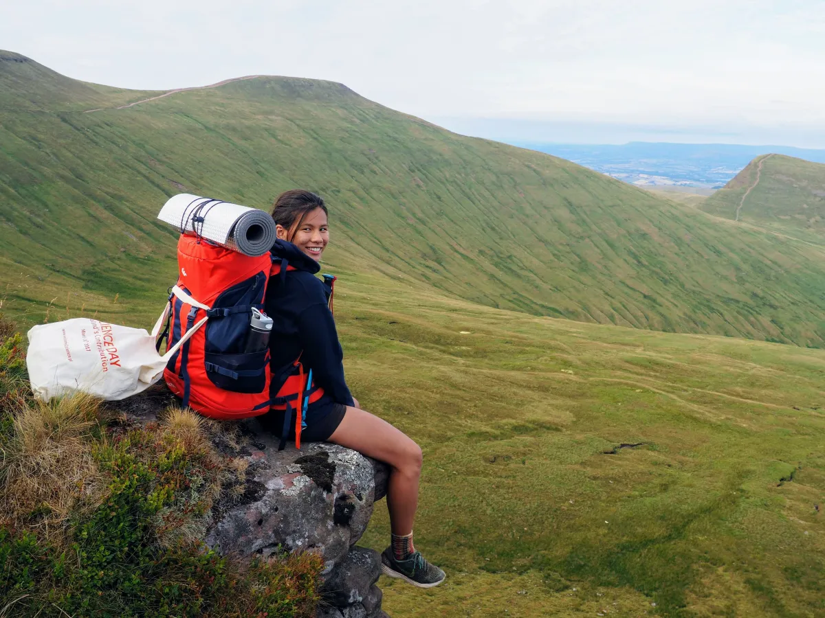
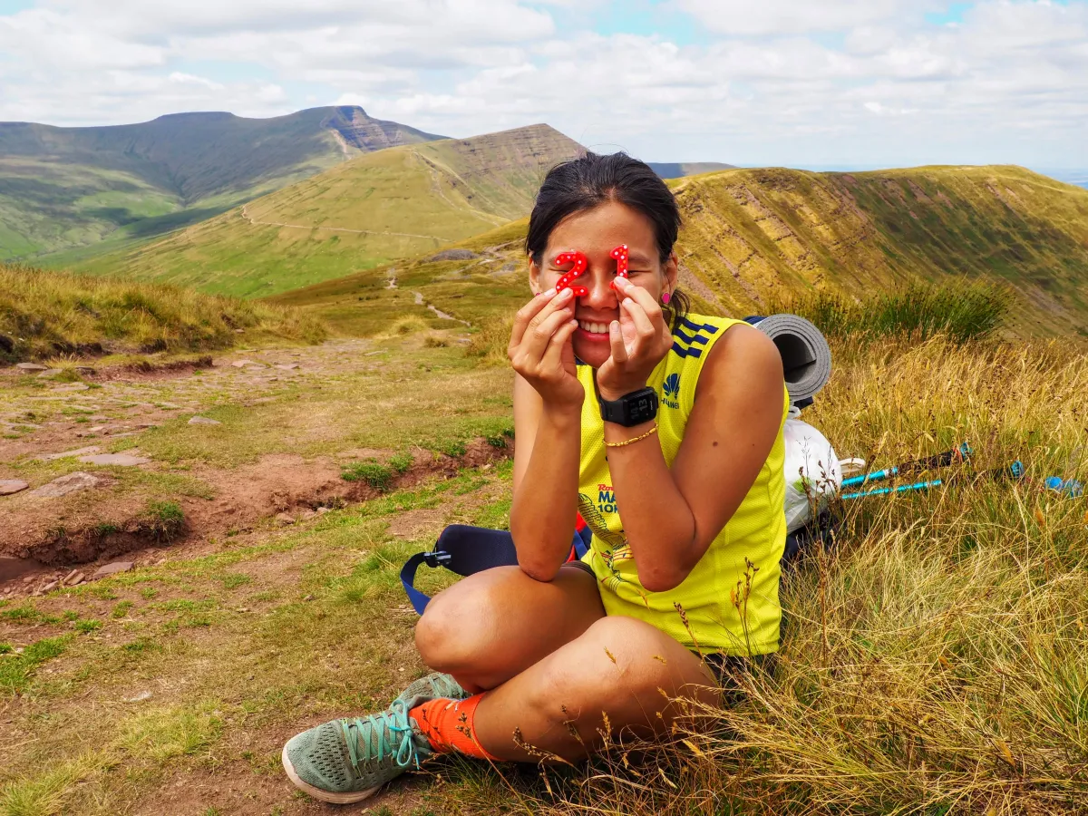 Birthday girl
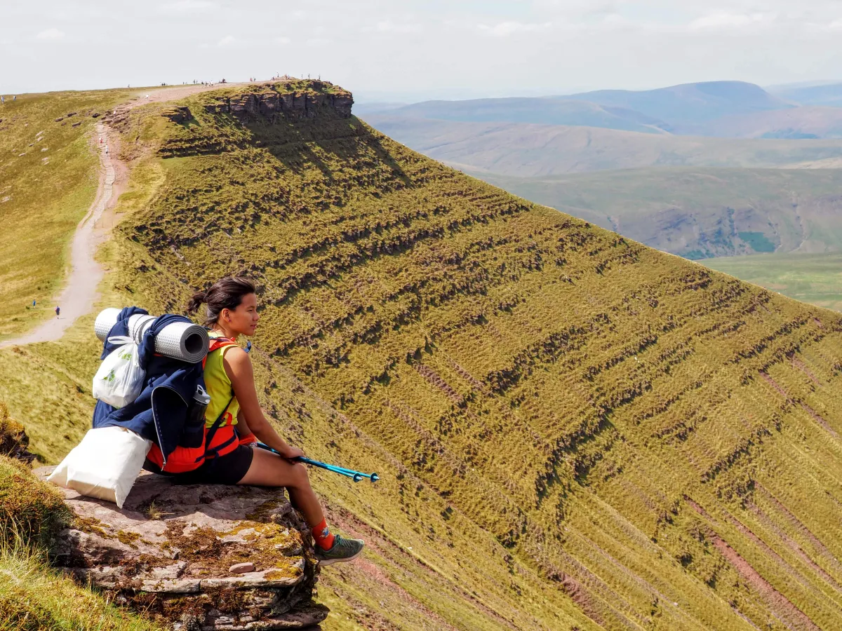
 Doesn’t that resemble y=min(0, sqrt(abs(x))*sgn(x))?
Back to Aber Village
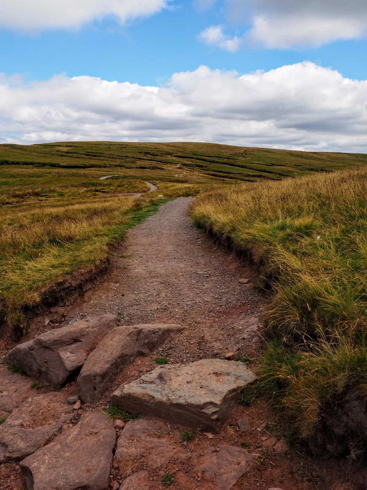 Winding path
Conclusion
Go to Brecon Beacons in Wales, what are you waiting for?
- Breathtaking views for those Instagrammers out there
- 10 peaks for all flavours: lazy, sporty, short, high, etc.
- Plenty of sheep: white, black, small, big, loud, etc.
- Best camping spot so far: fluffy grass and swimmable lake next to it
- And… don’t make our mistake and bring tons of water - steep paths are hard!